


Live in harmony with the hills
Nestled in nature
Set on the edge of Wiangaree’s ranges and Kyogle’s emergent charm, The Ranges is more than a location—it’s where your horizons expand into a new reality.
The Ranges presents an accessible retreat from the hustle of modern life. Here, we cater to a variety of visions: from one-acre Lifestyle Lots, to picturesque 12.5+ acre Hobby Farms, and sprawling 100acre+ holdings where your aspirations of sustainable living flourish.
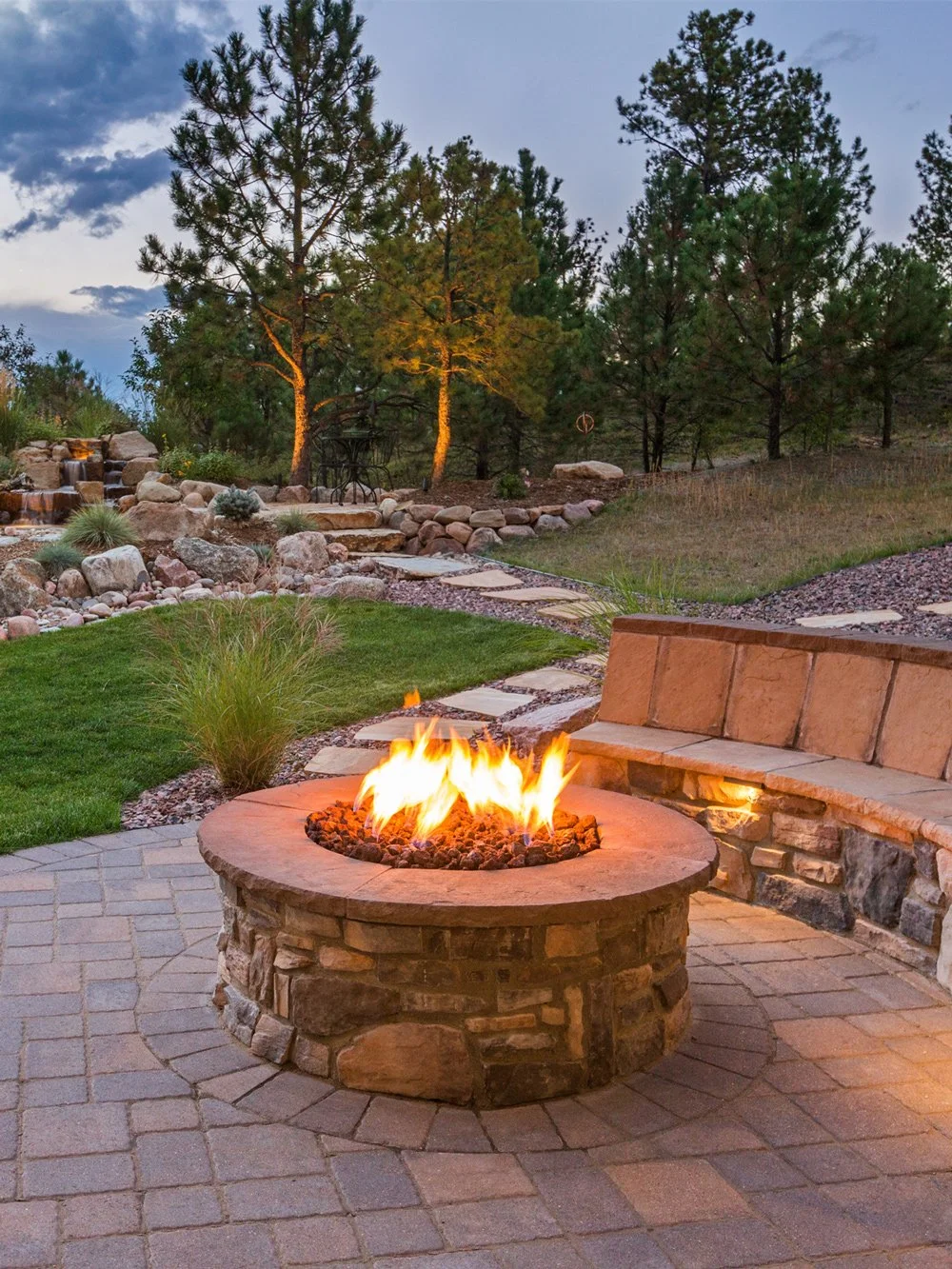
The lifestyle at The Ranges is a match of natural tranquillity and community warmth, offering a rare balance of peaceful countryside retreat and the vibrant pulse of a thriving country town.
At The Ranges you’re embracing a lifestyle where the air is fresher, the connections deeper, and life richer. It’s a place where good times echo against a backdrop of picturesque landscapes, where neighbours become friends, and where every sunset is the start of a beautiful tomorrow.
Join us, and anchor your roots in a place where life is lived as it’s meant to be—naturally and with a horizon of opportunities.

-
25 x 1 Acre Lots
LIFESTYLE LOTS
Each a clean slate offering picturesque views of the surrounding hills. Suited for those who are looking for a quiet corner of the world, these one-acre plots are the heart of convenience blended with natural beauty.
-

4 x 12-18 Acre Lots, 1 x 58 Acre Lot
HOBBY FARM LOTS
Set upon beautifully elevated land, with lush pastures fit for the finest cattle. With a sweeping 270-degree panorama of the ranges, these are our premium parcels, perfect for equestrian pursuits and a sustainable off-grid lifestyle.
-

1 x 100 Acre Lot, 1 x 176 Acre Lot
SECLUDED SANCTUARIES
For those seeking solace and space, our larger acreages, nestled closer to the ridge line mountains, offer an intimate retreat into nature. Bushy, yet usable, these lots promise utmost privacy and a deep connection with the environment.

Experience contemporary country living
Master Plan
LOT 1 - 5220 m2
LOT 2 - 5006 m2
LOT 3 - 5000 m2
LOT 4 - 5053 m2
LOT 5 - 5019 m2
LOT 6 - 5019 m2
LOT 7 - 1.313 ha
LOT 8 - 5000 m2
LOT 9 - 5000 m2
LOT 10 - 5008 m2
LOT 11 - 5124 m2
LOT 12 - 6139 m2
LOT 13 - 5019 m2
LOT 14 - 5013 m2
LOT 15 - 5183 m2
LOT 16 - 5038 m2
LOT 17 - 5474 m2
LOT 18 - 6064 m2
LOT 19 - 5000 m2
LOT 20 - 5000 m2
LOT 21 - 5000 m2
LOT 22 - 5000 m2
LOT 23 - 7507 m2
LOT 24 - 5802 m2
LOT 25 - 5542 m2
LOT 26 - 58.8 acres
LOT 27 - 100.7 acres
LOT 28 - 176.75 acres
LOT 29 - 15.26 acres
LOT 30 - 12.72 acres
LOT 31 - 13.32 acres
LOT 32 - 18.98 acres


Location

Kyogle Region
Major Towns
1. Kyogle
2. Casino
3. Lismore
4. Brisbane
5. Byron Bay
6. Ballina
7. Evans Head
National Parks & Reserves
8. Mount Clunie National Park
9. Tooloom National Park
10. Mount Barney National Park
11. Mount Nothofagus National Park
12. Mount Lindesay
13. Toonumbar State Conservation Area
14. Toonumbar National Park
15. Mebbin National Park
16. Bungabbee Nature Reserve
17. Richmond Range National Park
18. Cataract National Park
19. Hogarth Range Nature Reserve
20. Sugarloaf State Forest
21. Mount Pikapene National Park
22. Mallanganee National Park
23. Border Ranges National Park
Special Interest
24. Toonumbar Dam
25. Kyogle Cinema
26. Kyogle Mountain Bike Park
27. Kyogle Pool
28. Kyogle Farmer’s Markets
29. Northern Rivers Rail Trail Bentley

Wiangaree
Education
1. Wiangaree Public School
2. Kyogle High School
3. St John’s College Woodlawn
4. Trinity Catholic College Lismore
5. TAFE Casino
6. Southern Cross University Lismore
Shopping
7. Wiangaree General Store & Cafe
8. Wiangaree Mechanical
9. Kyogle Shopping Precinct
Health
10. Kyogle Community Health Centre
11. Kyogle Memorial Hospital
12. Kyogle Doctors
Transport
13. Gold Coast Airport
14. Kyogle Train Station
Special Interest
15. Aboody Park
16. Hermit’s Peak
17. The Helmet
18. Richmond River
19. Wiangaree Rodeo Grounds
20. Border Ranges National Park
21. Brushbox Falls Lookout

Introducing Millner Property
Millner Property are renowned for their deep-rooted expertise in the Northern Rivers region. Leading projects with a dedication that has shaped the local property landscape for over 14 years and developments valued in excess of $300 million. As a specialist in highly sought after residential land subdivisions, Director, Adam Leach’s intimate knowledge of this East Coast region ensures each development not only meets but exceeds expectations, fostering vibrant communities where he himself embraces the lifestyle. When he’s not leading projects, Adam enjoys a laid-back lifestyle, surfing the local waves and spending quality time with his family, truly living the ethos of the communities we create.

Experience contemporary country living
